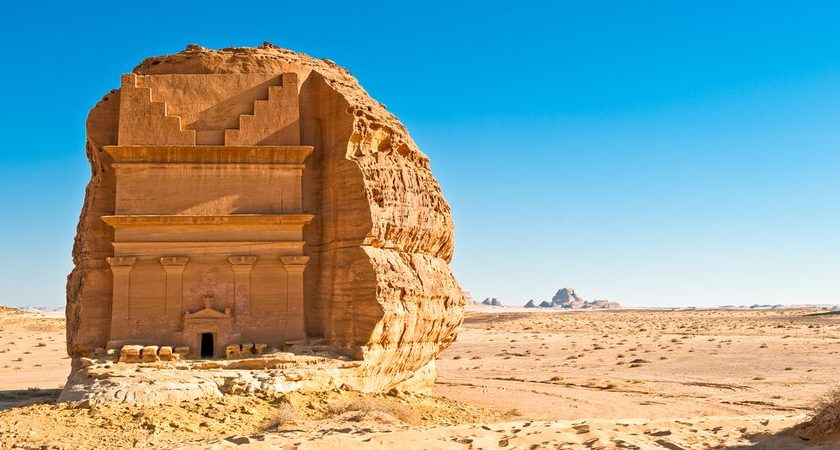
For travelers with a curious mind, map-geek travel: chasing cartographic oddities IRL is not just a hobby—it’s a journey into the unexpected. Imagine standing in a tiny village that looks entirely normal on the ground, but on the map, it is represented by a bizarre shape, strange lines, or a name that seems to defy logic. Cartography, the art and science of map-making, has quirks that only reveal themselves when you explore them in real life. And for map enthusiasts, there’s nothing more thrilling than seeing these oddities firsthand.
Maps are often seen as tools, mere guides to get from point A to point B. But for the map-geek traveler, maps are treasure maps of history, culture, and creativity. From distorted projections to “phantom” islands that never existed, chasing cartographic oddities allows travelers to discover stories that aren’t in guidebooks. Have you ever wondered why some countries appear larger than others on your world map? Or why some tiny islands look disproportionately huge? That’s where the adventure begins.
In this WentWorld.com journey, we will explore some of the strangest, funniest, and most intriguing cartographic oddities and show you how to visit them in real life. From geometric cities to phantom islands and borders that bend like puzzles, these places will make you see maps—and the world—differently.
Why Map-Geek Travel is More Than a Hobby
Traveling to chase cartographic oddities is about curiosity, observation, and a little bit of detective work. Maps often reflect history, politics, and mistakes, and these quirks are preserved in physical locations. For example, some roads were drawn incorrectly but became official boundaries over time. Other oddities are cultural in nature, such as towns that proudly embraced a peculiar shape on maps for tourism or legacy reasons.
Map-geek travel is also about noticing patterns others miss. Imagine a city that forms a near-perfect hexagon from above, or a village shaped like a star that looks invisible at street level. Visiting these places is thrilling because it challenges your perception and turns ordinary landscapes into puzzles waiting to be solved.

The Most Fascinating Cartographic Oddities to Chase
1. The Island That Doesn’t Exist: Sandy Island, South Pacific
For years, maps showed Sandy Island in the Coral Sea between Australia and New Caledonia. Sailors and cartographers included it, but expeditions revealed there was nothing but open ocean. It was a phantom island! Visiting the region today, travelers can navigate to where Sandy Island supposedly was, realizing that sometimes maps preserve myths.
2. The Serpentine Roads of Bolivia
The roads of Bolivia, especially near the Altiplano, look like scribbles on a map. Some even appear like dragons or serpents when viewed from above. Travelers often plan trips specifically to photograph these roads from high vantage points or use drones to capture their unusual geometry. Using airlines like LATAM Airlines, adventurers can reach La Paz and start exploring these cartographic wonders firsthand.
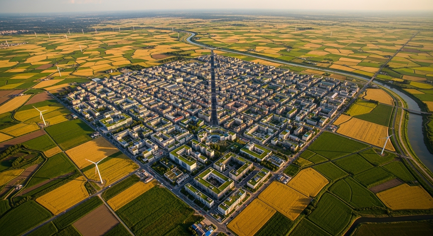
3. The Hexagonal City: Palmanova, Italy
Palmanova in northeastern Italy is a city designed as a perfect nine-pointed star, visible from maps and satellite imagery. Built in 1593 as a fortress city, its geometric precision is astonishing. Walking through the streets, you may forget the shape, but viewing the city from an aerial perspective or online maps instantly reveals the architectural marvel. This is a prime example of how cartographic oddities exist at the intersection of design, history, and art.
4. The Spite Fence Border: Baarle-Hertog/Baarle-Nassau, Belgium/Netherlands
One of the world’s most confusing borders is located in Baarle-Hertog (Belgium) and Baarle-Nassau (Netherlands). The town is full of enclaves and counter-enclaves, creating a patchwork that looks like a jigsaw puzzle on maps. Travelers can walk along streets that cross borders multiple times without realizing it, a physical adventure that perfectly mirrors the quirky map.
5. The Ghost Town on Google Maps: Centralia, Pennsylvania, USA
Centralia appears on maps as if it’s a normal town, but in reality, it’s mostly abandoned due to a coal mine fire burning underground for decades. Exploring it gives map-geek travelers an eerie thrill, a reminder that some cartographic oddities are tied to human error, industry, or catastrophe. More information about visiting safely can be found at Atlas Obscura.

Why These Oddities Matter to Travelers
Chasing cartographic oddities isn’t just a fun activity—it connects travelers to history, geography, and the stories behind maps. Every oddity has a narrative: mistaken coordinates, artistic designs, political intentions, or cultural pride. Visiting these locations transforms abstract lines on paper into real-life adventures. Have you ever realized that a line or shape on a map has a story? Exploring these places lets you live that story.
Planning Your Map-Geek Adventure
To make the most of map-geek travel, start by researching unusual maps or oddities online. Resources like National Geographic Maps and OpenStreetMap can highlight places that don’t fit the standard grid. Combine this with local guides or drone photography to capture perspectives that reveal the quirks fully.
Be prepared for surprises. Not every location will look as dramatic in person as it does on a map. Weather, urban development, and nature can change appearances. The thrill is in discovery and connecting what you see with the cartographic representation. And remember, many of these spots are sensitive environments or private lands, so respect local regulations and preserve the integrity of the place.
How Map-Geek Travel Changes Your Perspective
Engaging in map-geek travel shifts your perception of geography and exploration. It teaches patience, observation, and curiosity. You begin to notice patterns, anomalies, and stories embedded in maps that most people never question. It’s not just about seeing new places; it’s about understanding why they appear as they do and how history, politics, and human creativity shape our perception of the world.
Have you ever been fascinated by a line, shape, or anomaly on a map? Map-geek travel encourages you to step into the abstract and see the real-world implications. It turns passive map-reading into active exploration, and ordinary landscapes into living puzzles.
WentWorld.com invites you to join this curious journey, uncover hidden oddities, and share your discoveries with fellow map enthusiasts. Traveling this way transforms your experience from sightseeing to investigative adventure, connecting dots between cartography and reality in ways few other travel styles can.
Follow WentWorld.com on our social media platforms to stay updated on travel stories that reveal the strange, the unusual, and the overlooked corners of our planet. Who knows? Your next adventure might start with a map.
Catch up on the top stories and travel deals by subscribing to our newsletter!